From hurricane landfalls to tornado chasing, our meteorologists have experienced weather phenomena that truly show the danger, beauty and force of the natural world. In this recurring blog series, we tell real weather stories from their unique perspectives.
In this edition, our vice president of customer success, Cyrena-Marie Arnold, discusses her life-long fascination with extreme weather and how, when she stopped chasing extreme weather, it started chasing her.
My weather journey started in the 1980s. I was 5 years old, and my family had just moved from the Caribbean to Colorado. A severe thunderstorm, with torrential rain, wind and hail, had just run through our area near Aurora, but my mom was still nervous. She stood in the doorway of our home watching something outside. I walked next to her. The sky was gray, but also yellow and green and oddly quiet. And then I saw it: a funnel cloud that turned into a tornado. I was not scared, and this one singular moment, which my mom says I drew in pictures next to the word “halp” (help) for months after, forever changed my life.
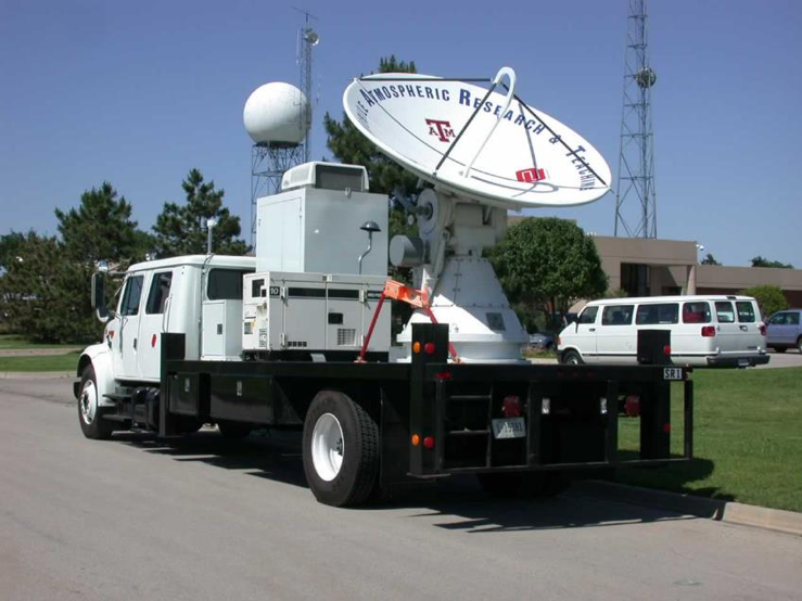 I have sought out extreme weather ever since. I went to the University of Oklahoma to learn all I could about tornadoes, lightning and thunderstorms. I chased tornadoes with the best of the best, and I even intercepted a landfalling hurricane in North Carolina in 2003 with the SMART-R mobile radar. I had to stay awake for 24 hours collecting radar data in the cab of a truck parked on a closed airport runway. At one point, we got out to feel the storm. Who knew rain could sting so bad in hurricane-force winds?
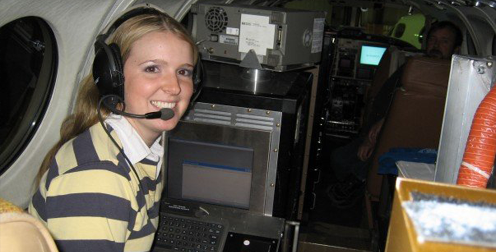
I continued my storm chasing after college by working with a NASA contractor that made TAMDAR, a weather sensor for aircraft that collected temperature, turbulence, icing and wind data as it flew. At the time, this technology was relatively new and untested – so of course I volunteered to be part of the testing team. I can assure you I agreed to go on an “icing and turbulence test flight” with a lump in my throat, but I was also so excited.
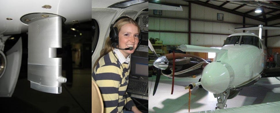 The University of Wyoming King Air took off, and we flew through clouds that caused our wings and windshield to ice over. After it melted, we flew along a mountain range to find as much turbulence as possible, and let me tell you, we found it. With a 5-point harness on, I still grabbed my seat as we got into the “good” stuff. I was manually recording our altitude and airspeed from the instruments in the cockpit to match up with our sensor data back at the office. About 2 hours and 15 minutes into the flight, vertical sheer turbulence threw the nose of the aircraft down and the tail straight up, and all we could see out the windshield was the ground. And then I sadly saw my breakfast again. We landed 15 minutes later, and I was able to “walk it off.” I credit this 2006 flight with completely eliminating my fear of turbulence.
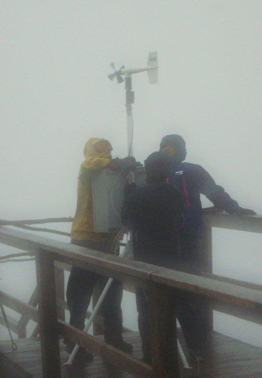 After finishing my work with the NASA contractor, I came to New Hampshire to work at the peak of Mount Washington, known globally as the home of the “world’s worst weather” for the coldest colds and the highest wind speeds ever recorded (231 mph, set in 1934). At the time, Superstorm Sandy was threatening, and we knew it had a good chance of approaching or breaking the wind speed record. We had one wind speed measuring location on the top of the mountain, but we badly wanted a second one at the summit to better capture the winds from the southeast.
We found a temporary but sturdy research-grade weather station thanks to Plymouth State University. I quickly assembled the station, took it to the summit and installed it at the perfect place with guidewires and turnbuckles to keep it stable during the worst conditions. The wind was howling. We could barely stand and a few gusts were so strong they took us 20 feet away from the station in an instant, where it took a solid minute or two to crawl back. It felt like we were out there for hours in the driving wind and rain. After it was fully installed, we returned to the safety of the observatory. (Editor’s note: I’m the one in the yellow coat.)
When we got back inside, my fellow researchers and I literally poured rainwater out of our boots as we changed our soaking-wet clothes. The data showed that we got the installation done in 99 mph sustained winds. We waited for the storm to end so we could collect the data. Sadly, the sensor experienced a catastrophic failure at 140 mph, we suspected because it was struck by debris; but this was still the strongest wind observed throughout the lifecycle of Superstorm Sandy.
Finally, after so many years of chasing severe weather, the severe weather found me instead. On June 10, 2010, I was driving home in Brighton, Colo., when I saw that eerie look in the sky – the one I’ve come to recognize as convective. I got home just before the hail began and the skies let loose with a fury. The hail sounded like gunshots as they pelted my house and the windspeeds approached 80 mph, as strong as a category 1 hurricane. I ran to the basement with my dogs for safety.
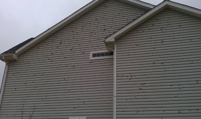 When things quieted down, we came back up to survey the damage. A spooky fog had settled thick above the ground, and the hail was piled up everywhere like so many snow drifts. Every surface on the exterior of my house was covered with holes. Every plant, tree, and flower in the development was stripped of leaves. The screens were torn and destroyed. Nothing looked the same. I had not even checked on my neighbors yet when the contractors started driving through the neighborhood handing out fliers. The next day, we had another hailstorm that was just as bad, and a third hail event hit just 2 weeks later. My heart aches for those that had their roof replaced immediately, only to have it destroyed again so quickly.
It’s because of this storm that I love being a part of Athenium Analytics. I’d been the collector of data from severe convective storms for so long, and to now see how this data can be actionable to help people is so rewarding – it brings my career full circle in a very fulfilling way. Having walked in the shoes of filing a weather claim (after claim, after claim…) gave me an entirely new perspective. I love explaining the weather to others and showing them how our solutions can really help their business.
Writer Bio
 Cyrena-Marie Arnold is the vice president of customer success at Athenium Analytics, leading the team charged with delighting and supporting all Athenium Analytics customers. Before joining the company in 2015, Cyrena served as the director of summit operations at the Mount Washington Observatory and an on-air meteorologist for NH1 News. Her background as a meteorologist makes her an excellent customer advocate, helping users solve complex weather and business-related challenges in claims and underwriting. Cyrena is also an active public speaker and promoter of STEM education. She has delivered dozens of keynote presentations at conferences and events, was selected for the Union Leader’s “40 under 40,” and was the 2019 NH Tech Professional of the Year.
______
Even though Cyrena’s hailstorm was almost 10 years ago, evidence of it can still be seen in Dexter, our weather verification and forensics solution. Dexter provides near real-time verification of hail and tornado paths that allow insurance companies to respond quickly after a storm hits.
- View Enhanced Fujita scale intensity ratings for tornadoes, plus tornado paths, damage swaths and damage points within hours after a severe weather event anywhere in the contiguous U.S.
- Upload and overlay portfolio and policy data to facilitate rapid catastrophic responses after major storms.
- Visualize your portfolio to assist with exposure management, loss mitigation and historical loss analysis.
- Generate hour-by-hour weather reports for key variables like rainfall accumulation, hail size, temperatures, wind speeds and more.
Learn more about the Dexter weather forensics software or contact our expert sales staff today to schedule a demo.

